Earlier this summer, Alex Glenn and I set out on a mission across the Wind River Range. We planned to do a version of the Wind River High Route, an off-trail endurance route that generally takes parties 6-10 days to complete. Our goal was to explore as many glaciers of the Winds as possible while documenting them through photographs. While we ended up not completing the full traverse due to unfavorable weather, we got to make a massive loop through the rugged and glaciated northern end of the range.
 To plan a trip like this, we skimmed through a few trip reports and began mapping out our route. Alex, Caltopo wiz, created us a map with potential campsites, photographic viewpoints, and a day-by-day itinerary.
To pack, we tried to mix some of the principles of ultralight backpacking with our mountaineering backgrounds, finding that balance of having enough gear to withstand bad weather, but light enough that we could cover the rugged terrain efficiently.
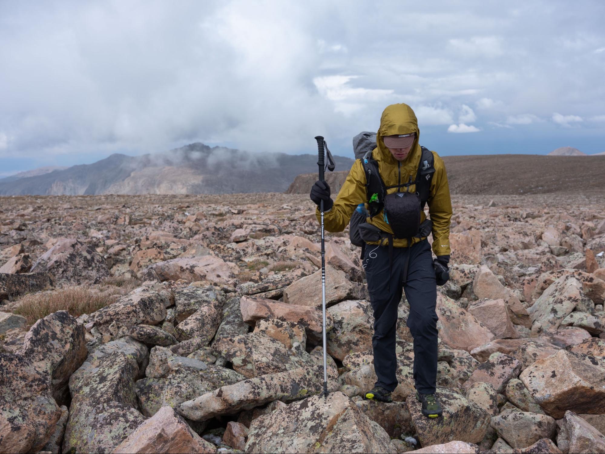
Day one was rough. It was hot, extremely smoky, and I think neither of us had gotten enough sleep the last few days, tying up loose ends before leaving for the trip. Our forecast was showing light snow with potential for thunder the next morning. We’d all but decided that we would need to change our day 1 itinerary, as sleeping on a plateau at 12,000 feet during a thunderstorm didn’t sound smart. We ended up bushwhacking to Bomber Lake, at the nice protected elevation of 10,500 feet.
At 3am, we were awoken to a thunderous boom overhead. I could see the lightning flash even with my eyes closed. It was snowing, too. We huddled in the tent until the thundersnow subsided around 11am. The sun came out, and we hastily packed up and began the long scramble up a couloir to regain the plateau, already a day behind on our itinerary.
We established camp and had a pretty miserable night in the cold and snow. This was a good reminder to always pack one more layer than what I think I’d need. After lots of instant coffee and Nesquik, we started day three, the big traverse to the Dinwoody Basin below Gannett Peak.

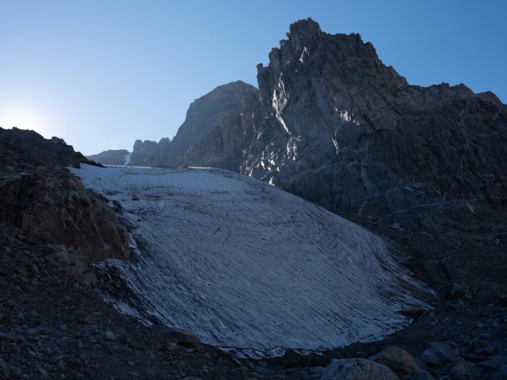
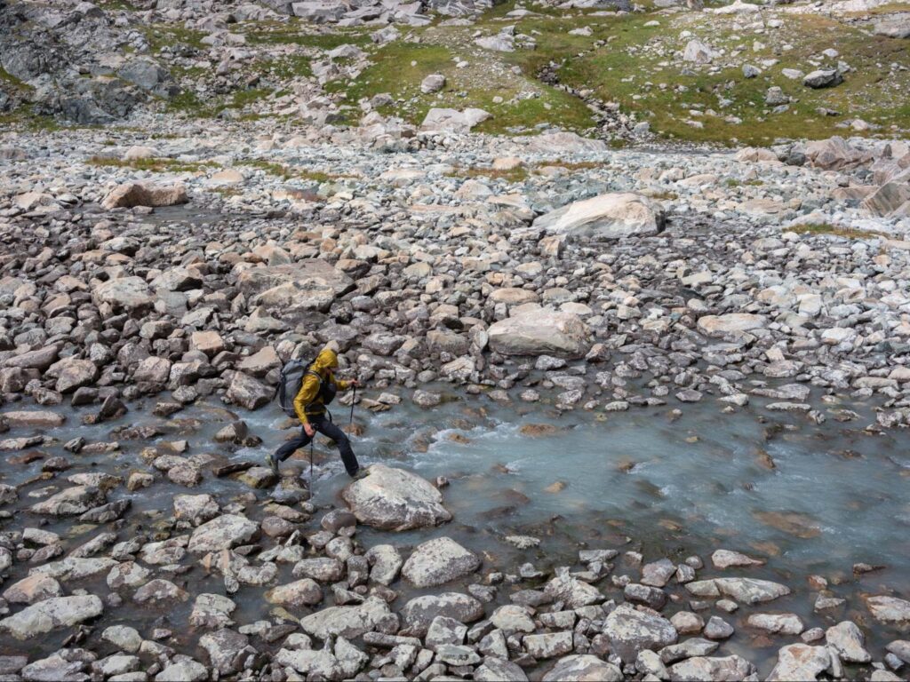
In retrospect, this stretch felt more like easy mountaineering than hiking. Constantly boulder-hopping and crossing low-angle glaciers, we eventually came upon a pretty sketchy passage between two very active and loose moraines, with a steep glacier dumping into it from above. I think a lot of trip reports undersell this little valley in terms of objective hazard—I was wishing I had a helmet as I watched a car-sized boulder slide down towards our path 500 feet ahead. After crossing at least 3 glaciers, we arrived at the Dinwoody Basin just before sunset. We hastily set up camp, knowing that tomorrow’s forecast was looking windy.
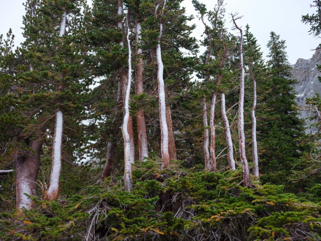
We awoke to strong winds, scary clouds, and all the reasons in the world to not go up to the next plateau that day. We retreated down-valley and found a perfect site nestled in a small krummholz forest. The rest of the day was spent photographing near camp, and we were now already 2 days behind. Our bailout was 25 miles away, and we wouldn’t have another bail point for a while after this. Because of this, we opted to spend the next two days exploring and photographing as much of the Dinwoody Basin as possible.
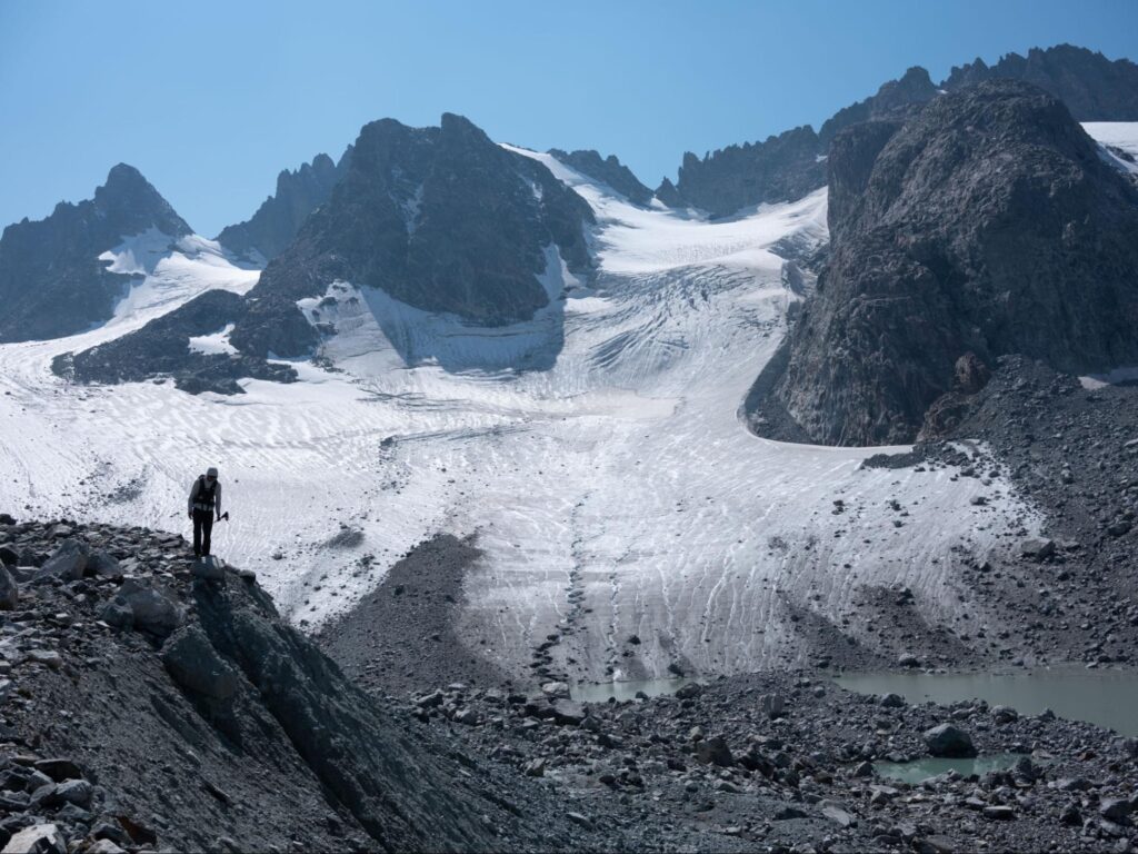
Drooling over alpine climbs, I wished I had my climbing gear. The ice and rock looked incredible! We boulder-hopped miles around Dinwoody Basin, checking out the toe of each glacier.
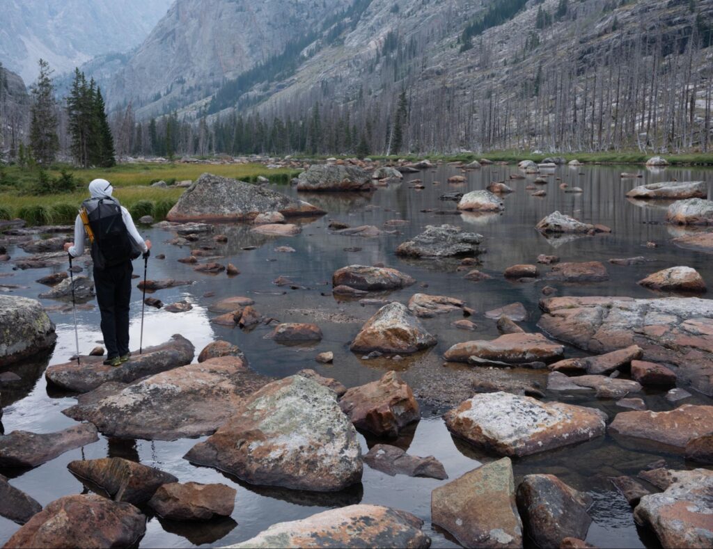
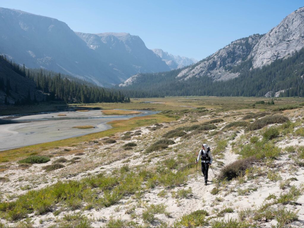
After spending some time exploring Gannett’s massive, glacial-carved valley, we waltzed out of there, with our legs feeling fresh from having some mellower days before. The 25-mile walk out was incredible. We went through countless environments, from granitic alpine to lush forests to sandy sagebrush plains to high grassy plateaus.
I think the terrain of the Winds was quite challenging, and this place will somehow find a way to push your limits. The setting and sense of remoteness makes it all worth it, though.
Food Spraydown:
- Most meals were “homemade” but we carried some Good-To-Go Backcountry Meals, too
- I used an MSR Pocket Rocket, along with an ultralight titanium nonstick pot. Most of my meals only required me to add boiling water.
- I aimed for ~3500 calories per day, but ended up eating 3000 per day, on average
- Our most memorable meals included:
- Refried bean & rice burrito
- Buffalo chicken packet burrito
- Smoked salmon & instant mashed potatoes and gravy (with a tortilla of course)
- It helped to remove packaging where we could, and separate food by day and meal
- Things I wouldn’t bring again:
- Olive Oil. Calorie-dense but messy and didn’t use much
- A 1-pound container of Nesquik. It may have exploded inside my bear sack at one point.
Gear Spraydown:
- For a trip of this length and remoteness, a 50L pack felt just right.
- I should have traded the Poncho for a gore-tex windbreaker, or brought both.
- It is essential to bring two pairs of socks, your feet will get wet.
- We brought a water-bottle bidet, which meant less TP to pack out, but an ice-cold #2 experience. I’d bring it again, though.
- We brought a real tent (~3 lbs) and I’m glad we did. In my opinion, a tarp wouldn’t have sufficed in the conditions we had.
- We carried microspikes, but never needed them. I still think it’s wise to bring them if you don’t have much experience walking on snow and ice.
- Bring a waterproof topographic map! We sell Wind River Range Maps from Beartooth Publishing.
Trip Stats: 65 miles